




Location and Directions to Baita Odles on Col Raiser in Val Gardena
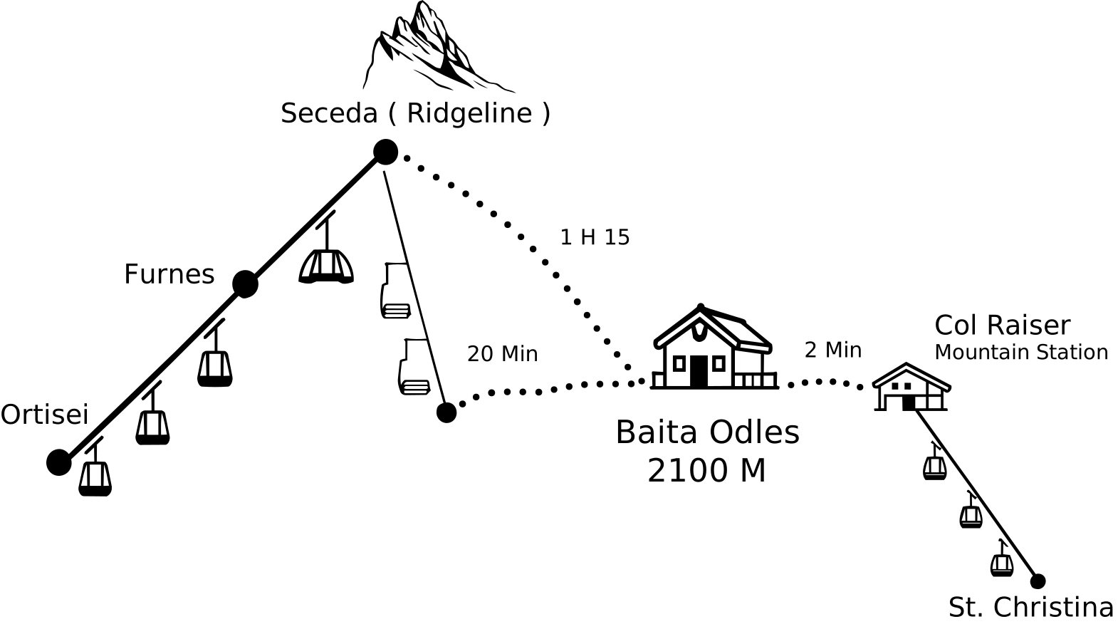
Baita Odles is a two-minute walk from the Col Raiser mountain station. Trails from Seceda, Ortisei, Cristauta and Daunëi lead directly to the hut.
How to reach Baita Odles
- Col Raiser Mountain Station
- approximately 2 min.
- Seceda Mountain Station
- approximately 1 hour and 15 min.
From Seceda to Baita Odles via the Fermeda chairlift
With the Seceda Premium Ticket, you can reach the hut from Ortisei in approximately 30 minutes on foot. First, take the cable car up to the mountain station, then walk approximately 10 minutes to the famous viewing platform with its striking view of the Odle peaks, one of Seceda’s well-known photo spots.
Then take the Fermeda chairlift. At the lower station follow trail no. 2C, which brings you to the hut in approximately 20 minutes.
Hiking map of the regionFrom Ortisei to Baita Odles via Seceda
From Ortisei the cable car takes you up to the Seceda mountain station with its breathtaking view of the famous Odle peaks. From there follow trail no. 2B to the Pieralongia Alp. Here you branch onto trail no. 4B towards Col Raiser. After approximately 30 minutes you reach the hut. By bike, we recommend following forest road 1A from the Seceda mountain station towards Col Raiser.
Hiking map of the region
From the Cristauta car park in Santa Cristina to Baita Odles
If you would like to walk up to the hut from Santa Cristina, start at the Cristauta car park. Trail no. 4 climbs steadily through the forest and reaches the hut after approximately one and a half hours. In the shade of the larches the walk stays pleasant even on warm summer days.
Hiking map of the region
From the Daunëi car park in Selva to Baita Odles
This walk starts at the Daunëi car park above Selva. Follow trail no. 3 through the forest past Juac to the Regensburger Hütte (Rifugio Firenze). From there trail no. 4 leads to the hut in approximately 20 minutes.
Hiking map of the region